1
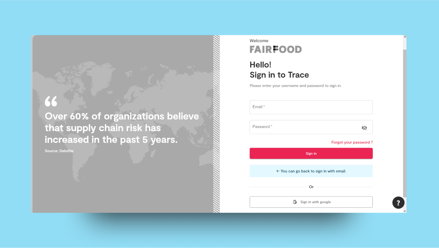
Login to the Platform
2
Navigate Dashboard
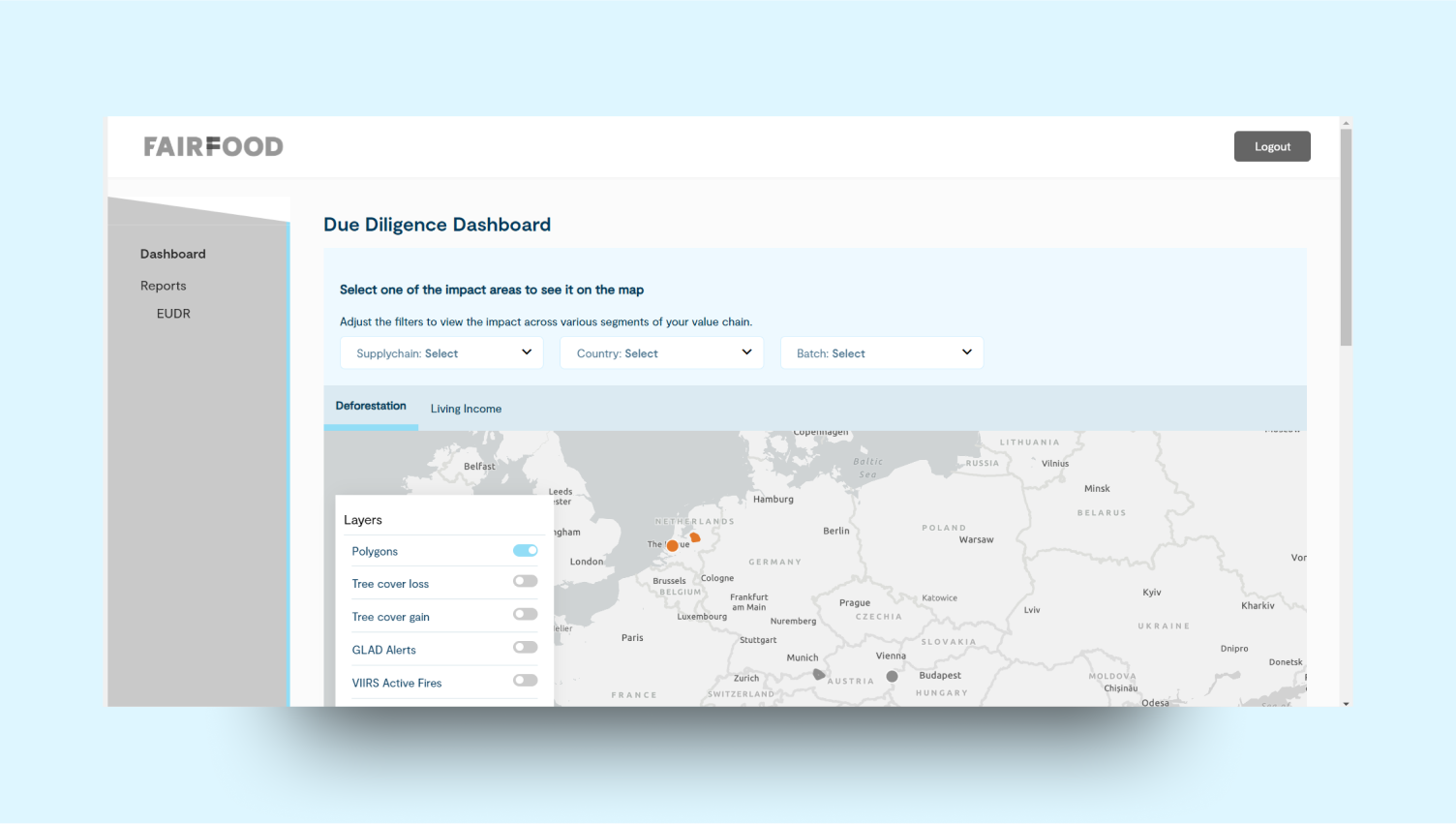
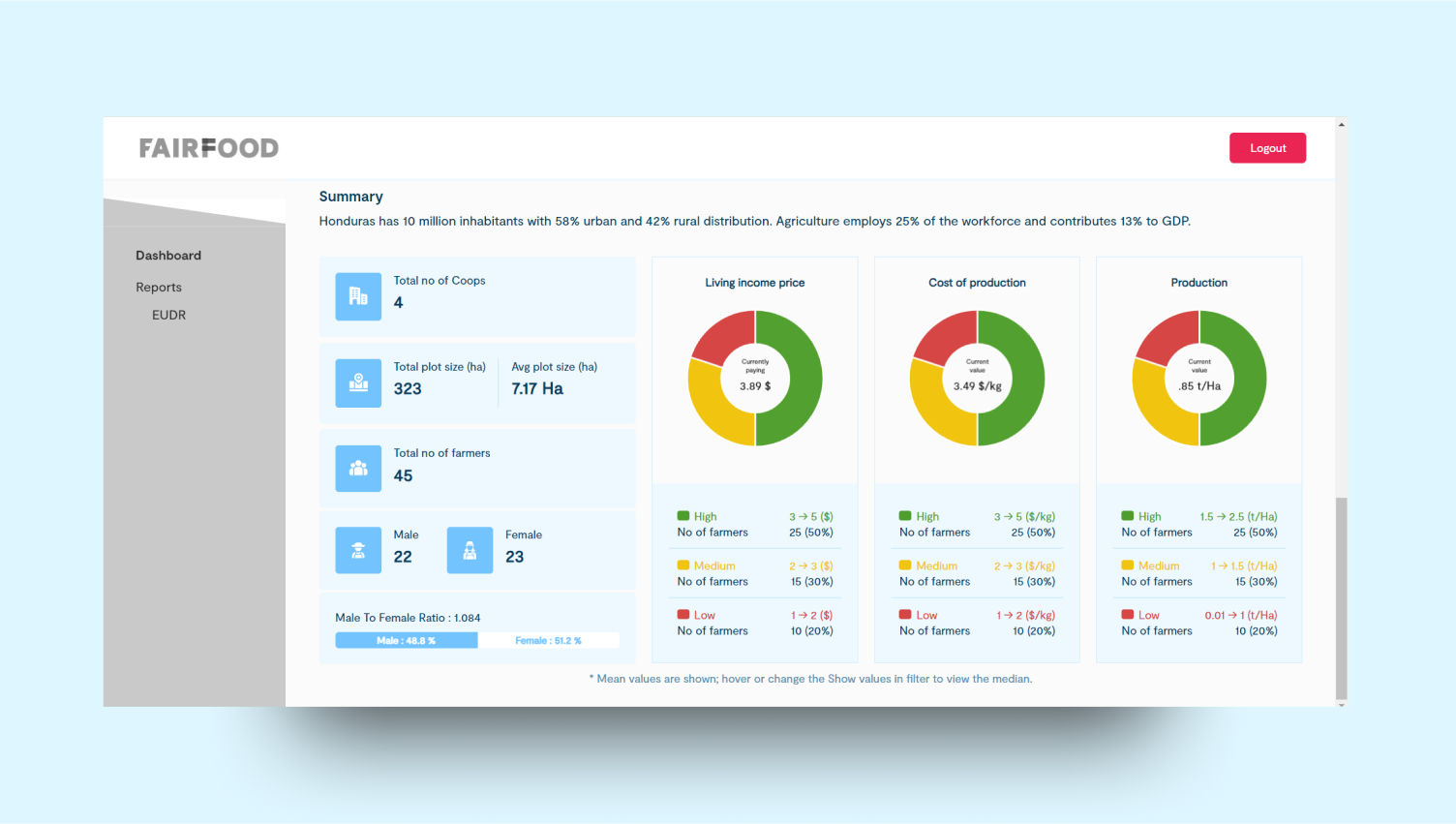
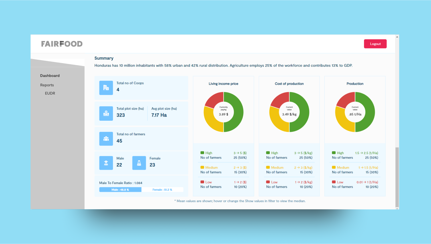
 Navigate is a platform designed to monitor key areas like deforestation, living income, emissions, biodiversity, and human rights. Users can switch between these categories to track and analyze data for each. The platform provides insights and tools to help manage and address environmental, economic, and social challenges effectively.
3
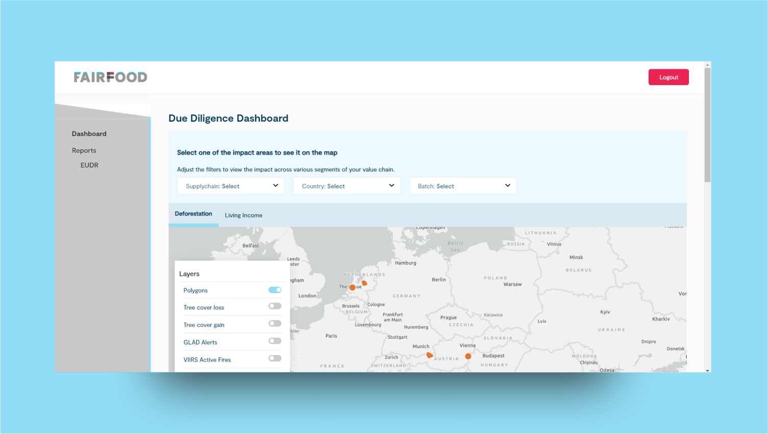
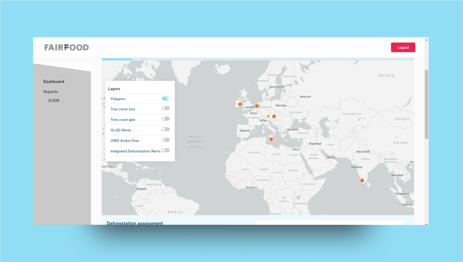
Filter section
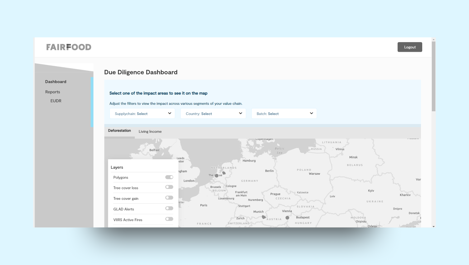
- Users can select impact areas on a map by adjusting filters for supply chain, country, and farmer group.
- This allows flexibility in viewing impacts across different segments of the value chain.
- In the Living Income category, users can choose to display values as either the mean or median.
- This feature enables more tailored and precise data analysis.
4
Map
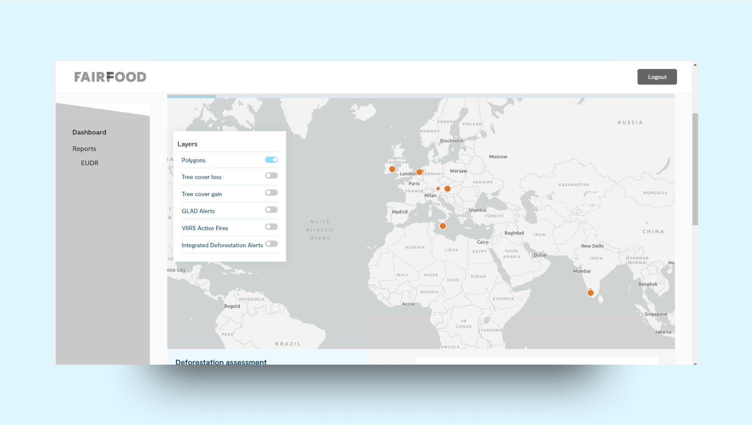
5
Assessment section
6
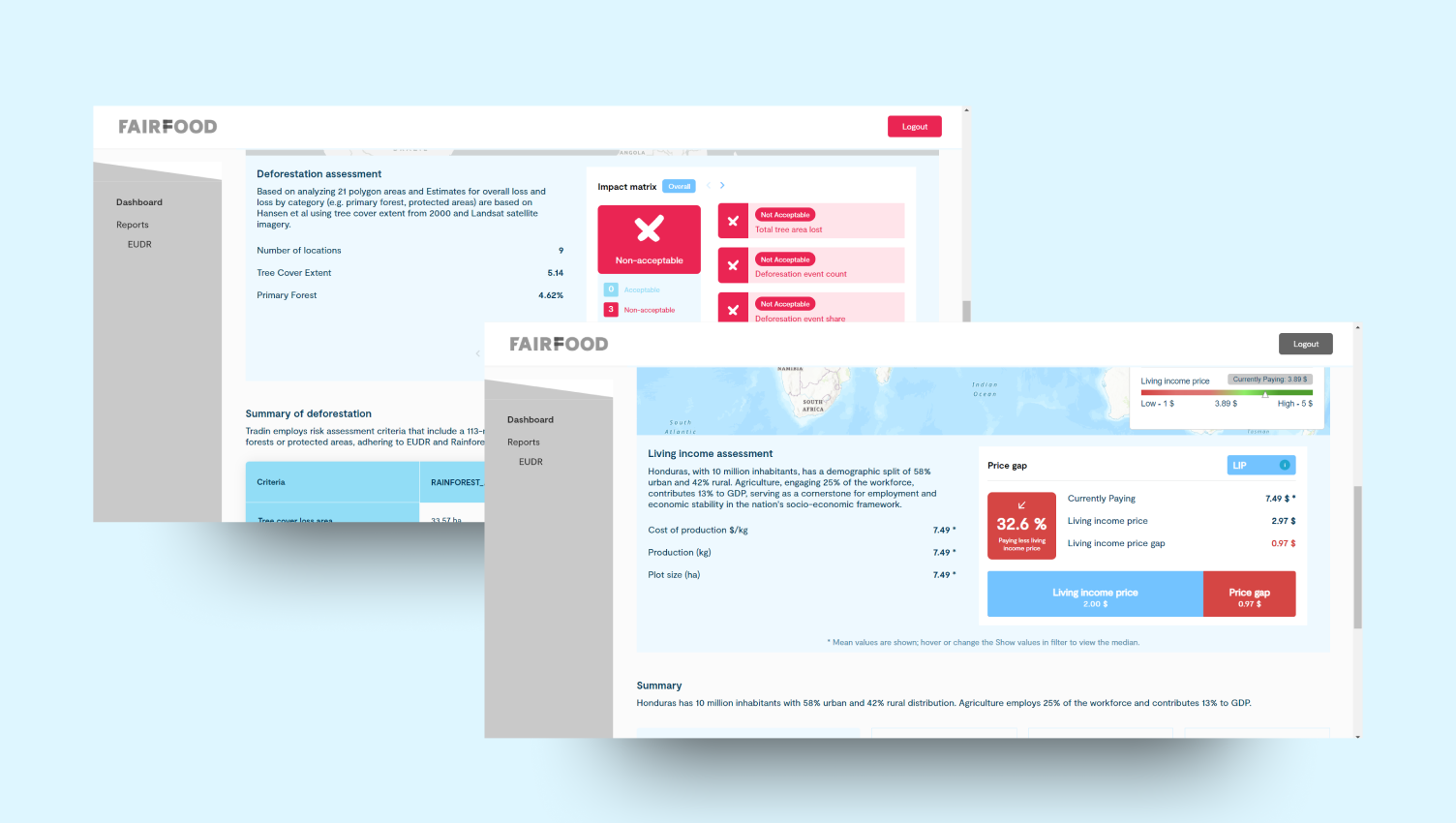
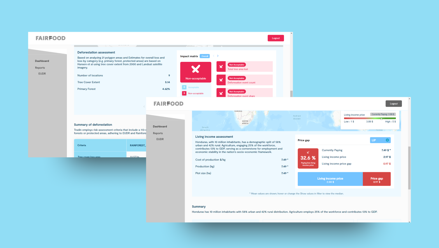
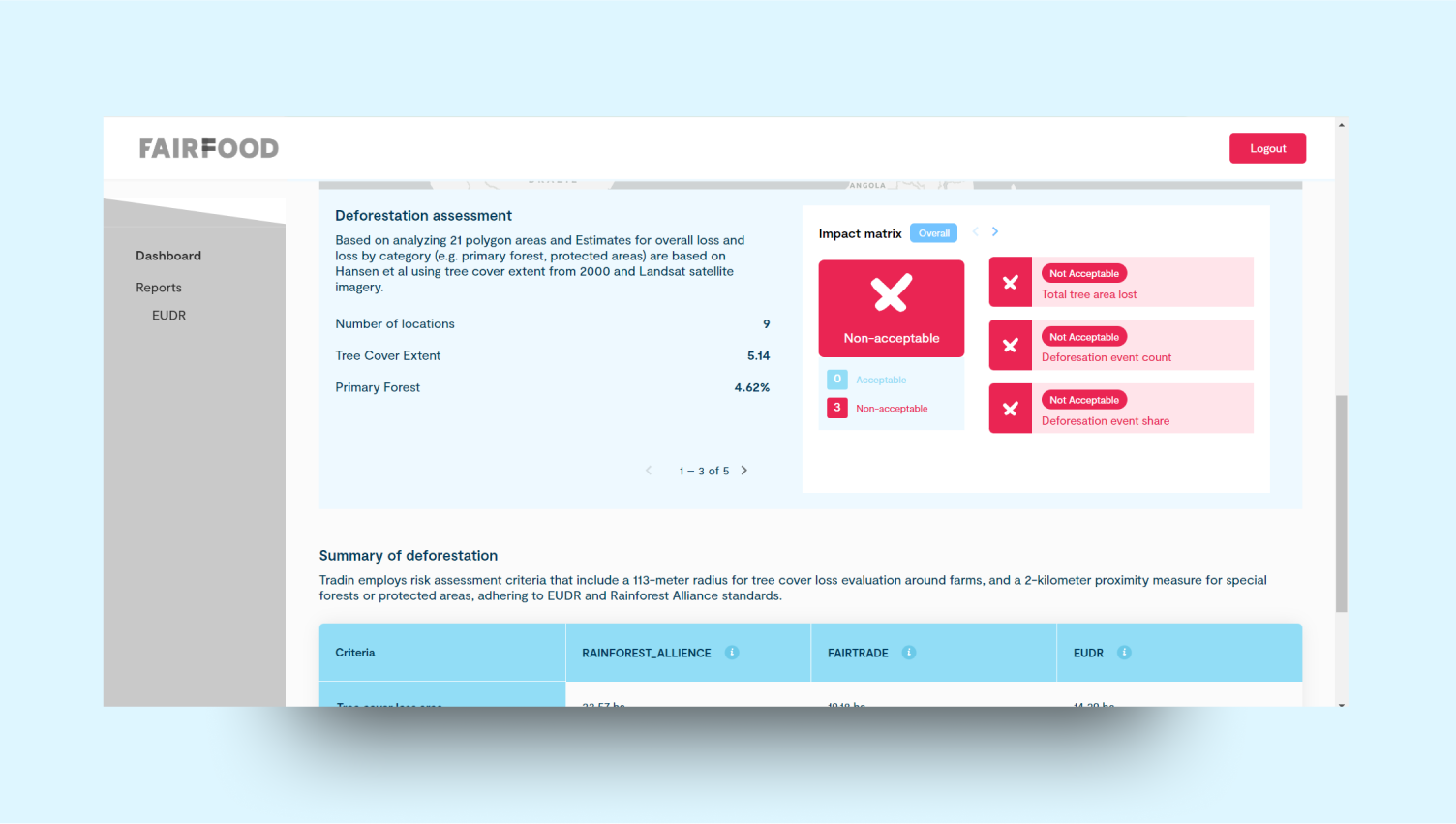
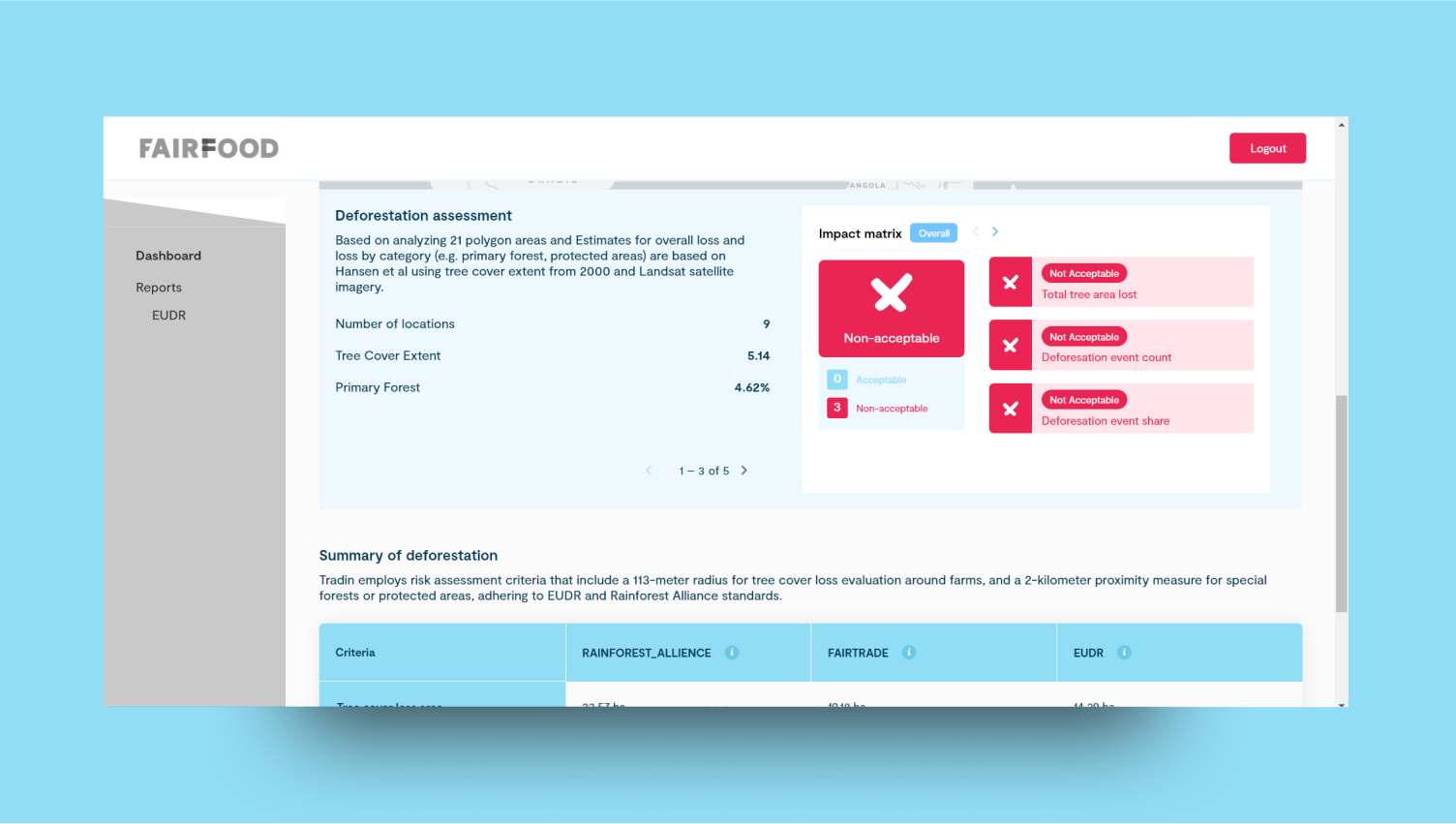
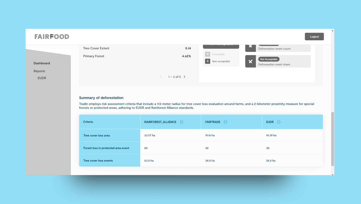
Deforestation assessment
7
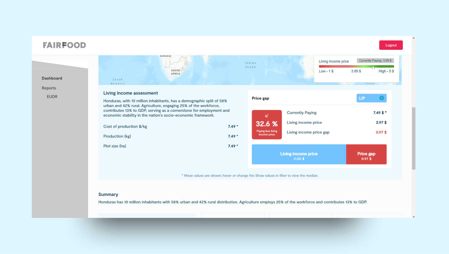
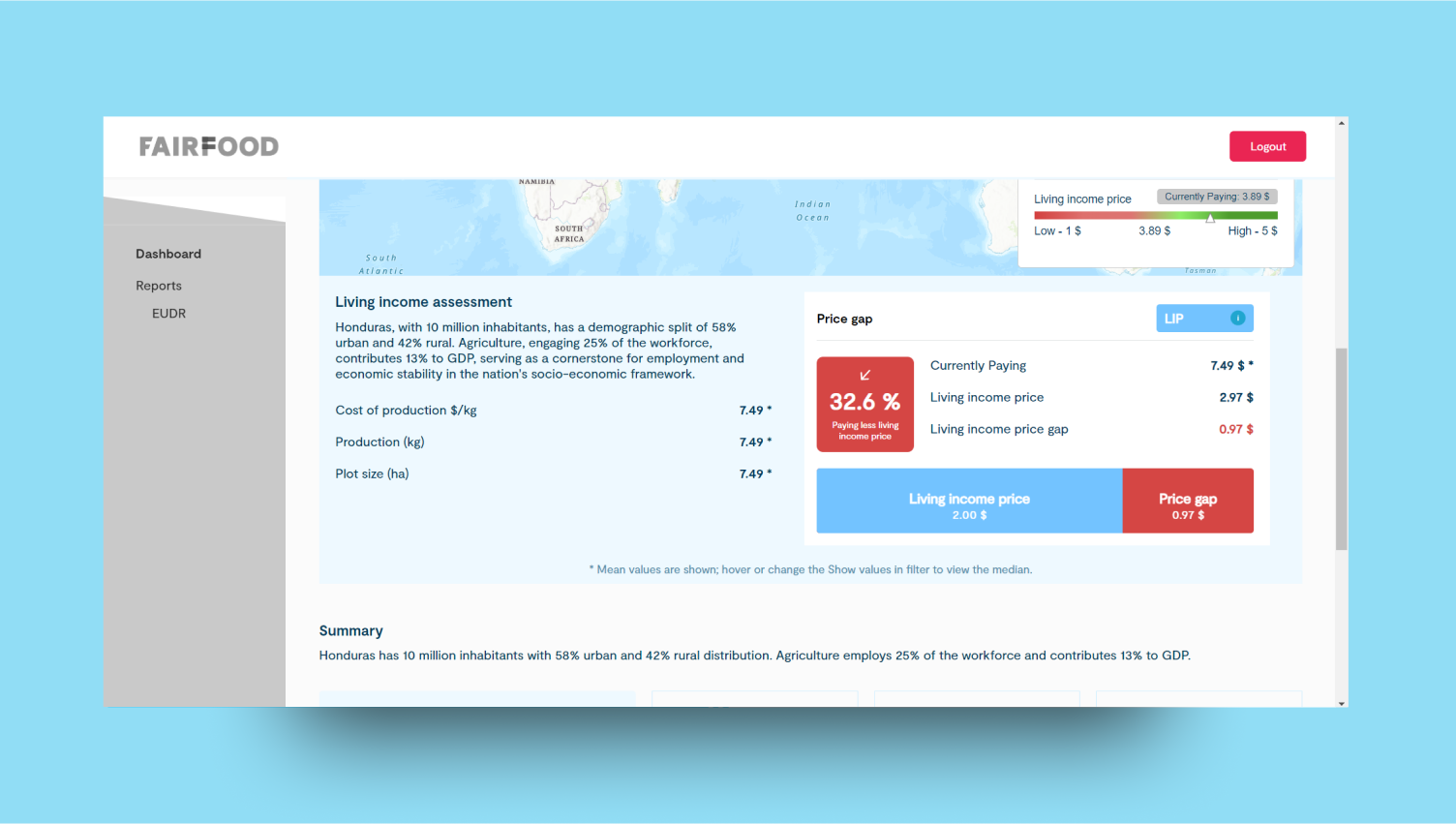
Living income assessment
8
Summary section
The summary section consolidates key evaluation values from each pillar, providing an overview of overall performance. It highlights critical metrics and their implications, offering a concise and comprehensive snapshot for effective analysis and decision-making.Deforestation Summary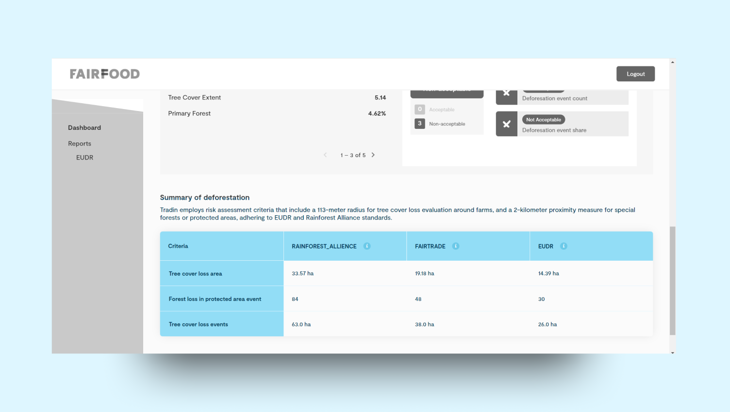
9
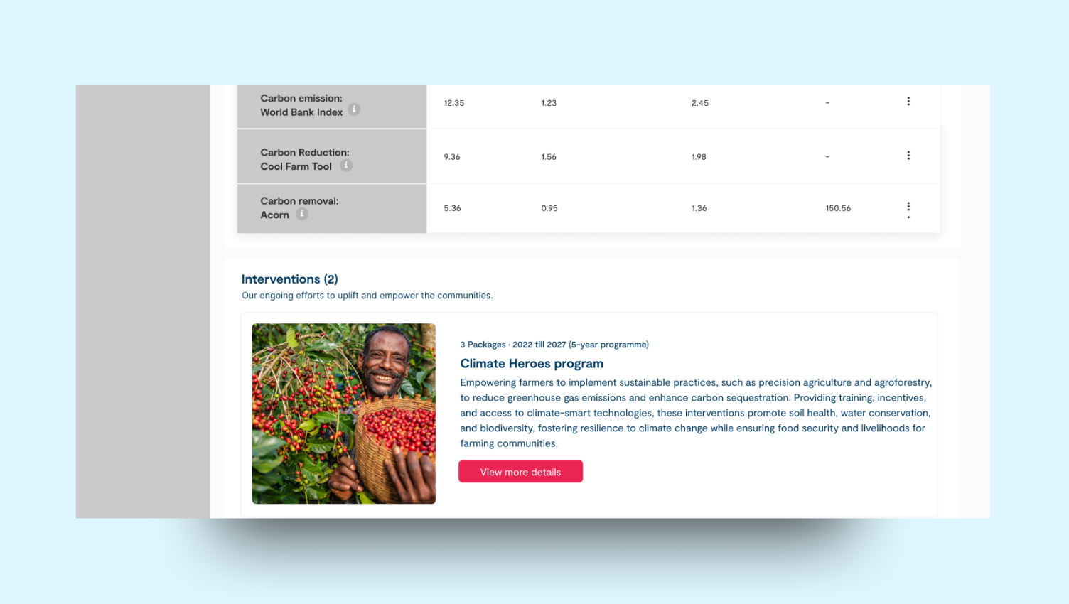
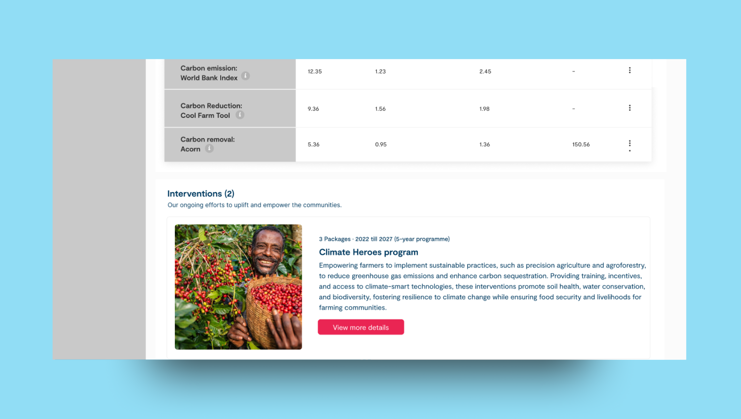
Intervention sections